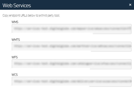
Using Maxar Web Services with Other Third-Party Tools
Use this feature to access the OGC URLs available to your selected account. These URLs can be added to geospatial applications that support the corresponding service. This allows on-demand integration of that service's content with the application. WMS (images), WMTS (tiled images), WFS (metadata), and WCS (downloads), if available to your account, can be integrated into applications that utilize these standards.
| For more information, please see Developer Guides. |
On the header bar, select Use With > Web Services. The Web Services dialog opens.
Web Services Dialog
- Select the URL for the service you want to use. The entire URL is highlighted.
- Right-click the selected text. From the context menu, select Copy.
Open a web browser or compatible geospatial application. Do one of the following:
- Web Browser Paste the URL to the address bar.
- Geospatial Application Add the URL according to the application's instructions. This is often referred to as adding a service, adding a layer, or adding a data source.
- When you are prompted to log in, enter your G-EGD credentials in the appropriate fields.