Creating Annotations
You can create annotations at any zoom level to indicate features on the map. There are several annotations tools you can choose from, including shapes, grids, military symbology, and magnified insets.
Creating Annotations
- On the side panel, select the Annotations icon
 . The Annotations pane opens.
 - Select Select Tool.
In the drop-down, select the type of annotation you want to create. Options for the annotation tool you selected appear in the pane. See Annotation Tools.
- Select the options you want to apply to the annotation (e.g., color, line weight, opacity).
In the viewport, draw the annotation.
Not all annotation types use the same drawing technique. Some use drag-and-drop, some use click-and-drag, some use a single click. Hover over the map to see a tooltip with more information about how to draw the annotation you selected.
- Press ESC to stop drawing, or select another option in the Annotations pane.
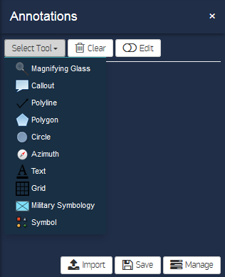
Annotation Tools
You can select from the following annotation tools.
Annotation Tools
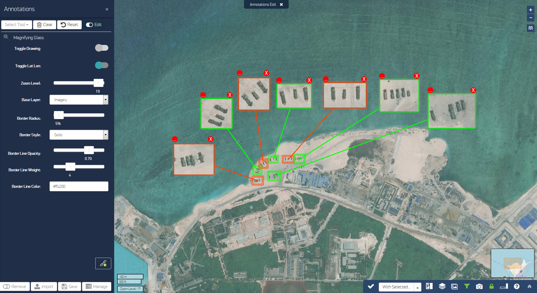
Magnifying Glass Create map insets.

Magnifying Glass Inset with Handles
To edit or delete an inset created with
Callout Draw a box that contains coordinates and can include additional text.
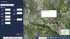
Callouts
- Polyline / Polygon / Circle / Symbol Create shapes to define an area on the map.
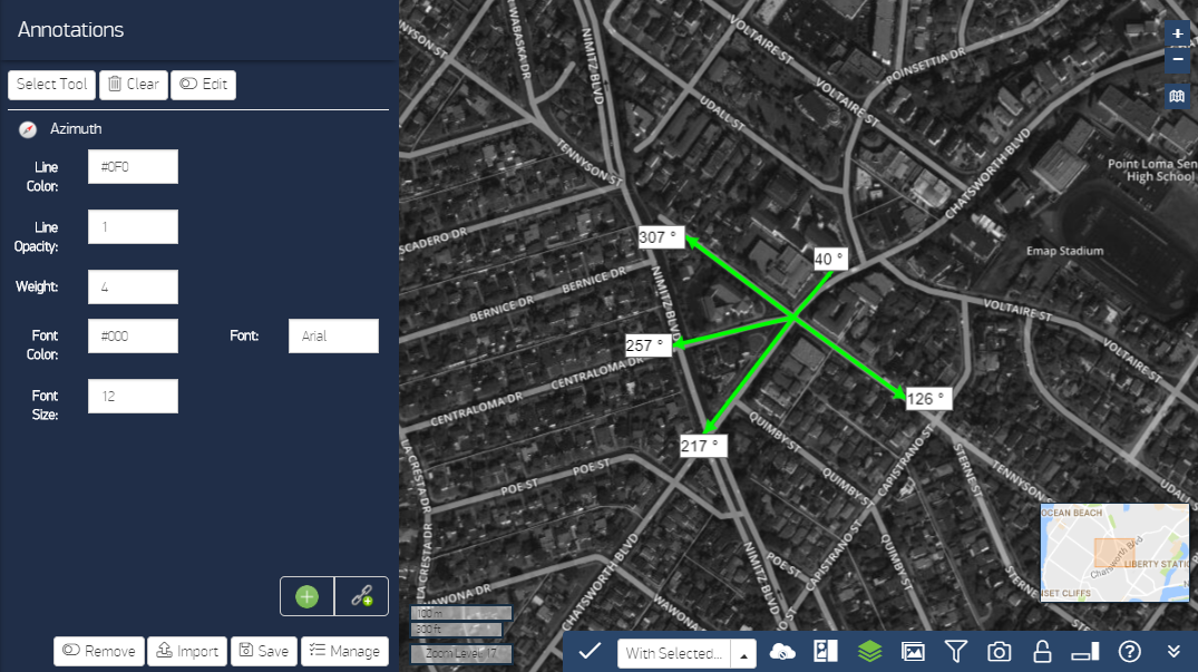
Azimuth Add a directional arrow and the angle of that arrow (e.g., 15°, 274°) from any point.
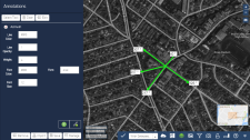
Azimuths Using Add to Last Point
- Text Add text captions to the map.
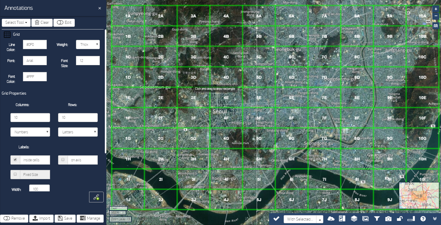
Grid As an alternative to using the coordinate reference grid, you can manually add a grid to a specific location.

Draw Grids
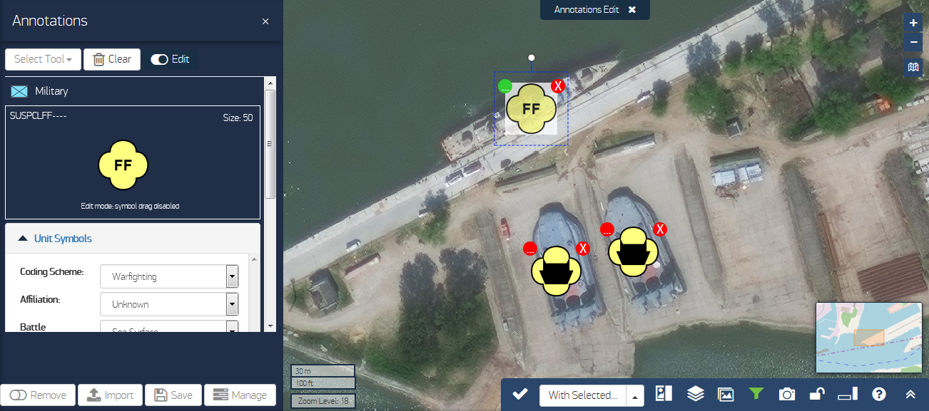
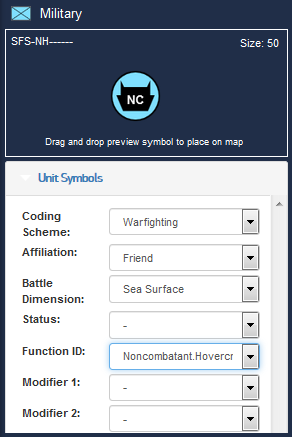
Military Symbology Create standard military symbology (2525c) and add it to the map. You can see a preview of your symbol in the preview box at the top of the pane.
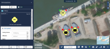
Military Symbology with Handles
 More Information
Unit Symbols Use the options in this menu to select the symbol you want.
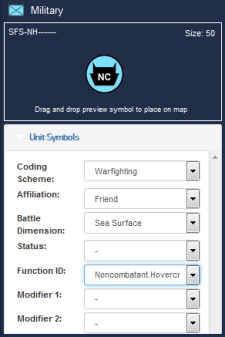
Creating Military Symbology
The symbol size does not change in the preview as you edit your symbol. When you drag the symbol to the map it will be the size you selected in the Display Properties section. After you place a symbol on the map, it remains that size even if you zoom to a different level in the viewport (i. e., the symbol size does not scale).
- Placement If you wish use specific coordinates for the symbol's placement, enter them in this drop-down menu. Otherwise, you can drag the symbol from the preview box onto the map. When you pan in the viewport, your symbols stay where you placed them.
- Display Properties Use these options to change the color, line size, and other visual attributes of the symbol.
- Text Modifiers Enter values to annotate your symbol with specific information.
To edit or delete an inset created with

More Information
- To associate an annotation with an image strip, select
 , then select an image tile in the Carousel. Save your annotation set. The associated image loads when you view your annotation set again.
 - To continue drawing from the last point of the most recent annotation, select
 . When creating an azimuth, this will draw another arrow from the same starting point.