Working with Visual Navigation (VISNAV) & Land Use Land Cover (LULC) Data
VISNAV Land Cover (LC) is a raster dataset produced by MDA under contract to the NGA. The NGA has several Land Use Land Cover (LULC) products under the VISNAV program. Each product supports a variety of applications, such as broad area search, cartographic vegetation mapping, vehicle mobility modeling, engineering planning, and humanitarian disaster response. G-EGD currently hosts the 2013 update of the VISNAV LC dataset.

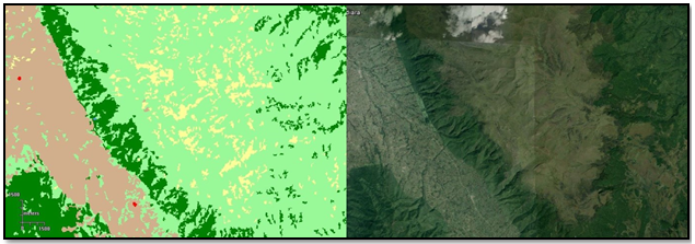
VISNAV LC Coverage
The original VISNAV LC was derived in 2010-11 from Landsat data. This product was last updated in 2013 with 2012 Landsat imagery. LULC classes include forest, urban, and agriculture, while Feature classes include golf courses, open pit mines, and sand dunes.
VISNAV LC Classification
The VISNAV LC product has 12 LULC classes and 13 feature classes. A different color is associated with each type of LULC classification or feature.

VISNAV LC Classification Scheme
- Zoom to level 11 or higher.
On the side panel, select the Layers icon
 . The Layers pane opens.
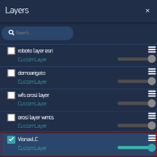
Layers Pane with VISNAV LC Layer
Select VISNAV LC. The legend appears. Pan or zoom for more detailed views of your area of interest.
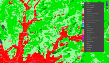
VISNAV LC Layer


More Information
- Currently, only VISNAV LC data is available. ELC and HD data may become available in a future release.
- Use the slider to adjust a layer's transparency and drag the layers within the pane to change their stacking order. See Changing the Stacking Order & Transparency of Custom Layers.