Working with the Refined Persistent Change Model (RPM)
The Refined Persistent Change Model (RPM) is a vector dataset produced by MDA under contract to the NGA. This dataset depicts annual changes that were detected based on 30-meter Landsat imagery. Maxar hosts this dataset within G-EGD and makes it available from within G-EGD, as well as directly through WMS and WFS services.
MDA delivers the RPM dataset to the NGA annually and divides those deliveries into six regions, or areas of interest (AOIs), which are produced and delivered at different points throughout the year. A map roughly defines the boundaries of each AOI.
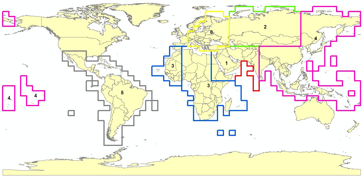
MDA Regional AOIs
Zoom to level 13 or higher.
RPM Change Detection layer information is visible at zoom levels 13 through 20. To maintain top performance when using the RPM Change Detection layer within other OGC client applications, the WMS service limits the rendering of polygons to level 13 and higher, and the WFS service limits requests to returning no more than 50,000 polygons regardless of the specified bounding box. See Using Maxar Web Services with Other Third-Party Tools.
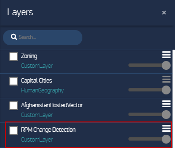
On the side panel, select the Layers icon
 . The Layers pane opens.
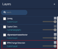
Layers Pane with RPM Change Detection
Select RPM Change Detection. The legend appears.
In the legend, select the Filters icon
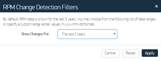
 . The RPM Change Detection Filters dialog opens.
RPM Change Detection Filters Dialog
- In the Show Changes For drop-down list, select a period of years, or choose Custom Range and use the date selectors to set start and end dates.
Select Apply. The map updates to show only the polygons for the time period you set.
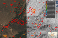
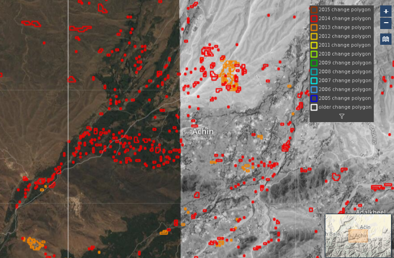
RPM Polygons and Change Detection Legend
More Information
- You can export RPM vector data using the snapshot and mashup mechanisms. When the RPM Change Detection layer is turned on, snapshots and mashups include a zipped shapefile of the RPM polygons. See Adding Imagery to the Library.
- Use the slider to adjust a layer's transparency and drag the layers within the pane to change their stacking order. See Changing the Stacking Order & Transparency of Custom Layers.
- To see additional information about the RPM Change Detection layer, in the Layers pane, select the Action Menu
 , then select Information.
 - After viewing the polygons on the map and noting the year of a detected change, use the Carousel to find and view imagery from before or after the change. See Comparing Imagery.